By early morning, Ventus Australis is cruising across Nassau Bay into the remote archipelago that includes Cape Horn National Park. Weather and sea conditions permitting, we shall go ashore on the windswept island that harbors legendary Cape Horn (Cabo de Hornos). Discovered in 1616 by a Dutch maritime
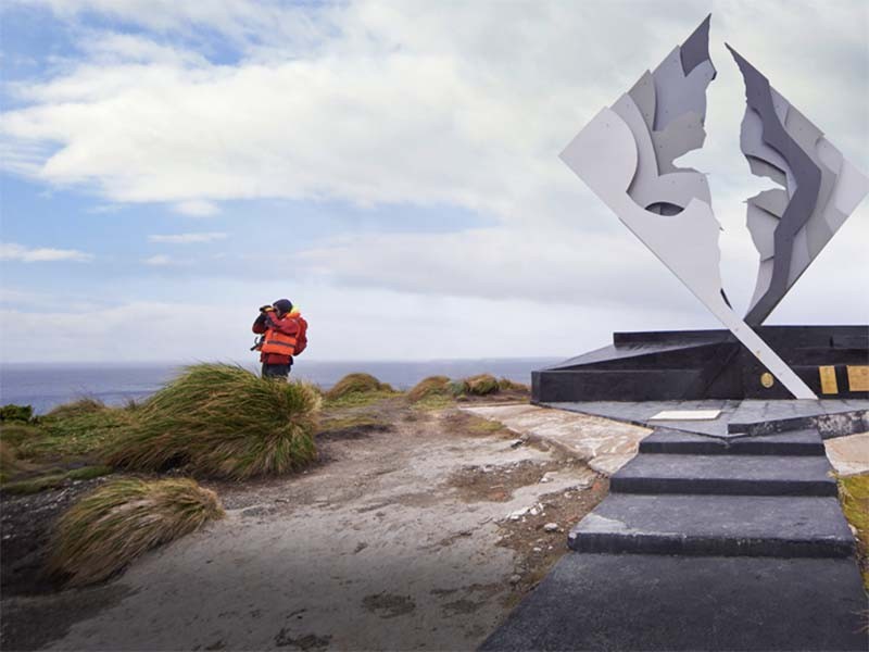
expedition -- and named after the town of Hoorn in West Friesland -- Cape Horn is a sheer 425-meter (1,394-foot) high rocky promontory overlooking the turbulent waters of the Drake Passage. For many years it was the only navigation route between the Pacific and Atlantic, and was often referred to as the "End of the Earth." The park was declared a World Bios- phere Reserve by UNESCO in 2005. The Chilean navy maintains a permanent lighthouse on the island, staffed by a lightkeeper and his family, as well as the tiny Stella Maris Chapel and modern Cape Horn Monument.
Sailing back across Nassau Bay, we anchor at fabled Wulaia Bay, one of the few places in the archipelago where the human history is just as compelling as the natural environment. Originally the site of one of the region’s largest Yámana aboriginal settlements, the bay was described by Charles Darwin and sketched by Captain FitzRoy in the 1830s during their voyages on the HMS Beagle. This area is also renowned for its mesmerizing beauty and dramatic geography. After a visit to the Australis-sponsored museum in the old radio station -- which is especially strong on the Yámana people and European missionaries in the area -- passengers have a choice of three hikes (of increasing degrees of difficulty) that ascend the heavily wooden mountain behind the bay. On all of these you will be strolling through an enchanted Magellan forest of lengas, coigües, canelos, ferns, and other endemic fauna to reach a panoramic viewpoint overlooking the bay. Before leaving Wulaia Bay, drop something into the wooden mail barrel inside the museum – letters or postcards meant to be hand delivered by future travelers – an ancient mariner tradition revived by Australis.
Read more

